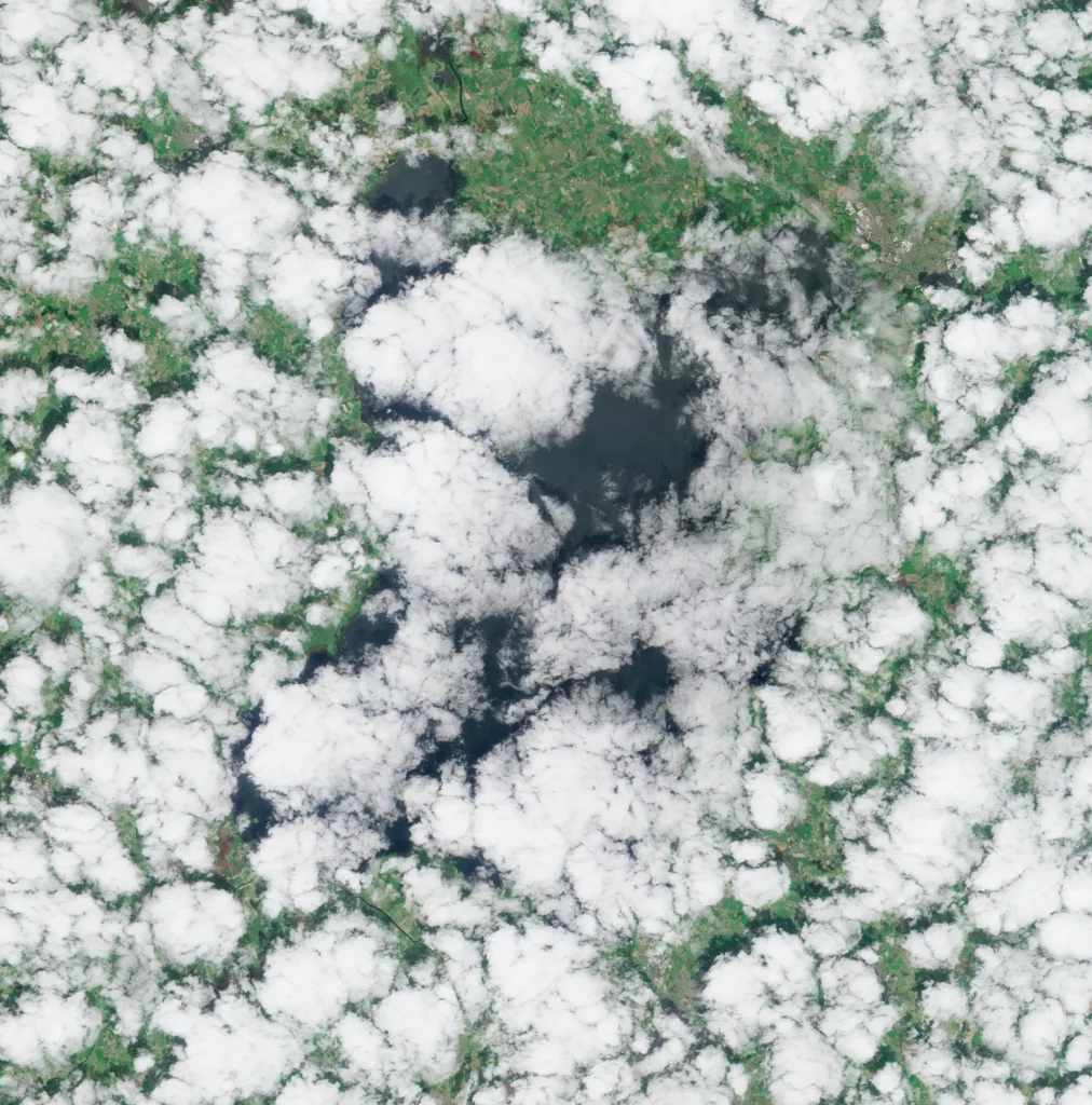
Cloud cover represents a common obstacle in satellite-based environmental detection.
!Cloudy Day in Lough Neagh, Northern Ireland
When clouds obstruct views, optical satellites cannot capture what is happening on Earth's surface, creating gaps in observation and data. These gaps:
- Reduce the frequency of reliable observation. - Disrupt continuous data collection for identifying patterns. - Limit effectiveness of machine learning models. - Create blind spots during potentially critical periods.
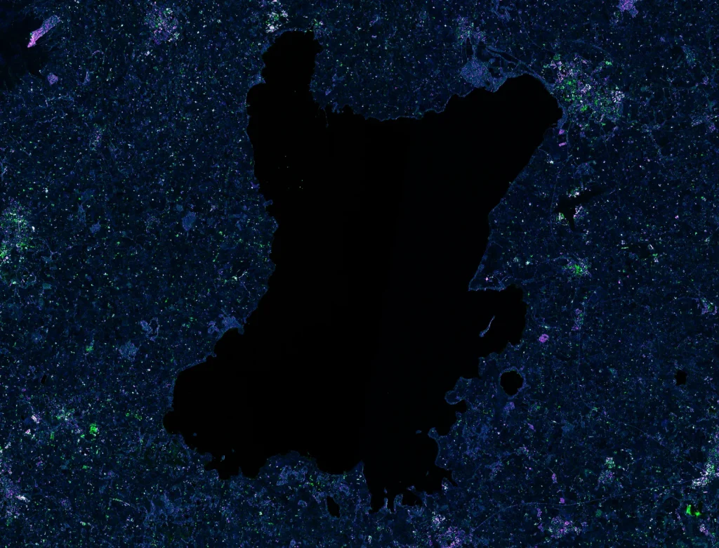
The SAR Solution: Seeing Through Clouds
Synthetic Aperture Radar (SAR) technology offers a solution to the cloudy challenges. SAR systems actively emit pulses of energy and then record the amount of energy reflected back after it interacts with Earth and its physical features (buildings, roads, mountains, forests, water bodies, sea ice, etc).
For example, the Sentinel-1 mission from the European Space Agency is a constellation of two sun-synchronous polar-orbiting satellites. They travel over the Earth's poles and pass over the same location of the Earth at the same local time each day. Sentinel satellites share the same orbital plane with 180° orbital phasing difference.
AST's SAR-Based Methodology
AST develops a processing chain that transforms raw SAR data into actionable insights.
!Lough Neagh radar imaging with Sentinel-1
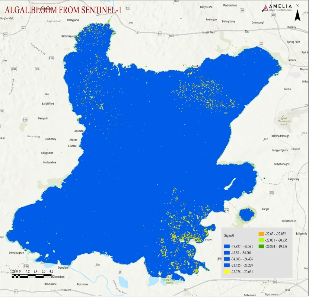
As a use case, here is how AST detects and analyzes harmful algal blooms using SAR imagery:
- Data Acquisition: Download SAR imagery from data sources. - Region Subset: Subset data to focus specifically on the area of interest. In this case, Lough Neagh in Northern Ireland. - Orbital Correction: Correct for geolocation errors due to predicted satellite orbit inaccuracies. - Thermal Noise Removal: Remove any thermal noise that may affect low-backscatter areas like open water. - Radiometric Calibration: Convert raw digital numbers into calibrated backscatter values (sigma naught, beta naught, or gamma naught) for quantitative analysis and comparison across different images and time periods. - Speckle Filtering: SAR images contain speckle noise, which can interfere with water classification. The Lee Sigma filter is effective for water surfaces, balancing speckle reduction and feature retention. - Range-Doppler Terrain Correction: Correct for geometric distortions caused by topography to ensure accurate geolocation of features. - Decibelization of Radar Backscatter Coefficients: Decibelization (dB conversion) converts radar backscatter coefficients (Sigma0) into a logarithmic scale. SAR backscatter values vary exponentially, so expressing them in decibels (dB) makes them easier to analyze. - Thresholding Using Band Math: Apply calibrated thresholding techniques using band mathematics to identify the unique backscatter signature of algal blooms, typically falling within the -24 to -20 dB range in VV (Vertical Transmit-Vertical Receive) polarization. - Classification: Apply additional algorithms to further classify and precisely identify the most probable algal bloom regions.
SAR Analysis Output
!AST's SAR Analysis for Environmental Detection
Business Applications
By overcoming the limitations of cloud cover, SAR-based approaches enable continuous monitoring, comprehensive coverage, time-series analysis, and more reliable information for better decision-making.
Whether you are responsible for managing water quality, water bodies, or aquaculture investments and operations, AST's SAR-based capabilities can offer the intelligence you need to make informed decisions.
Learn more about AST's planetary intelligence platform and contact us today.