
The Platform
Planetary Intelligence. Better decisions, powered by space.
Amelia fuses satellite imagery, ground sensors, and AI into decision-grade knowledge your team can act on.
Active harvest across the majority of fields. Bare soil exposure increasing rapidly. Amelia tracks completion rates across thousands of parcels in near-real-time.
Drag timeline to travel through time
A single satellite image is a snapshot. Stack months of satellite data together and you see a fuller story: what grew, what was harvested, what changed, and what’s coming next. The value is in the combination.
There’s more to see
Satellite data, one of the most underutilised business assets, reveals what is happening across entire regions, continuously, without anyone needing to be there.
Organisations with this access spot opportunities faster, reduce risk earlier, and make better decisions knowing what is actually happening on the ground.
Built to give you a competitive edge
Unlock the intelligence hidden between layers of data
Save Money
Intuitive ask and search engine for analysis in minutes, not months.
Reduce Complexity
Easier collaboration to reduce project management overhead.
Protect Assets
Autonomous monitoring and alerts that save time and reduce risk.
Increase Access
AI systems and proprietary algorithms for deeper sector insights.
Gain Outcomes
Go beyond digital analysis and gain real-world results.
For your organisation
Reinforced workflows and capabilities
Each workflow chains multiple capabilities together, each output feeds the next. The result is something no single model could reach alone.
Sustainable Aviation Fuel
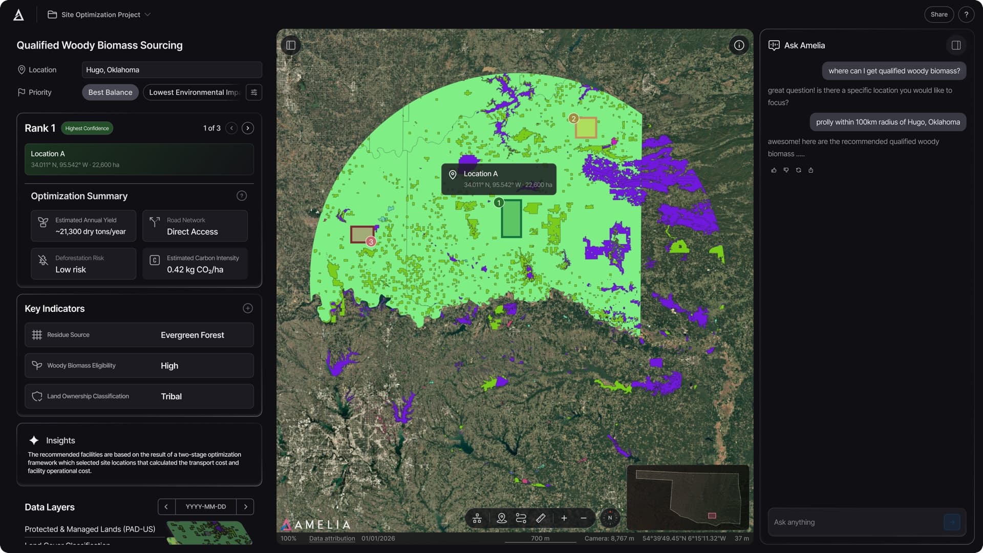
Where should we build our storage hubs and pre-treatment facilities?
Score candidate sites against feedstock proximity, road access, grid connection, and planning constraints to identify optimal locations for your hub network.
Example query
“Show me RSB-eligible feedstock sourcing areas within 50km of our facilities”
Capabilities are like ingredients, workflows are like recipes. Together they create a complete dish.
Supply Chain Network Design
Evaluate hub placements, routing, and costs across multiple scenarios
Feedstock Sourcing
Map biomass availability, estimate yields, and rank collection zones
Regulatory Compliance
Cross-reference sites against ISCC, RSB, and EPA RFS frameworks
One platform. Four ways to work
Analysis in minutes, not months. What used to require a GIS team is now accessible to everyone.
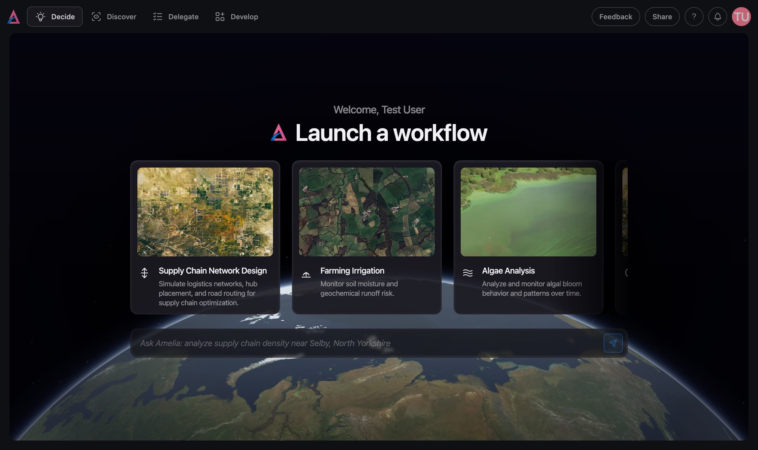
Decide
Ask better questions, get better decisions.
Ask a question in plain language. Amelia orchestrates the analysis — selecting satellites, running models, cross-referencing data — and delivers findings you can act on.
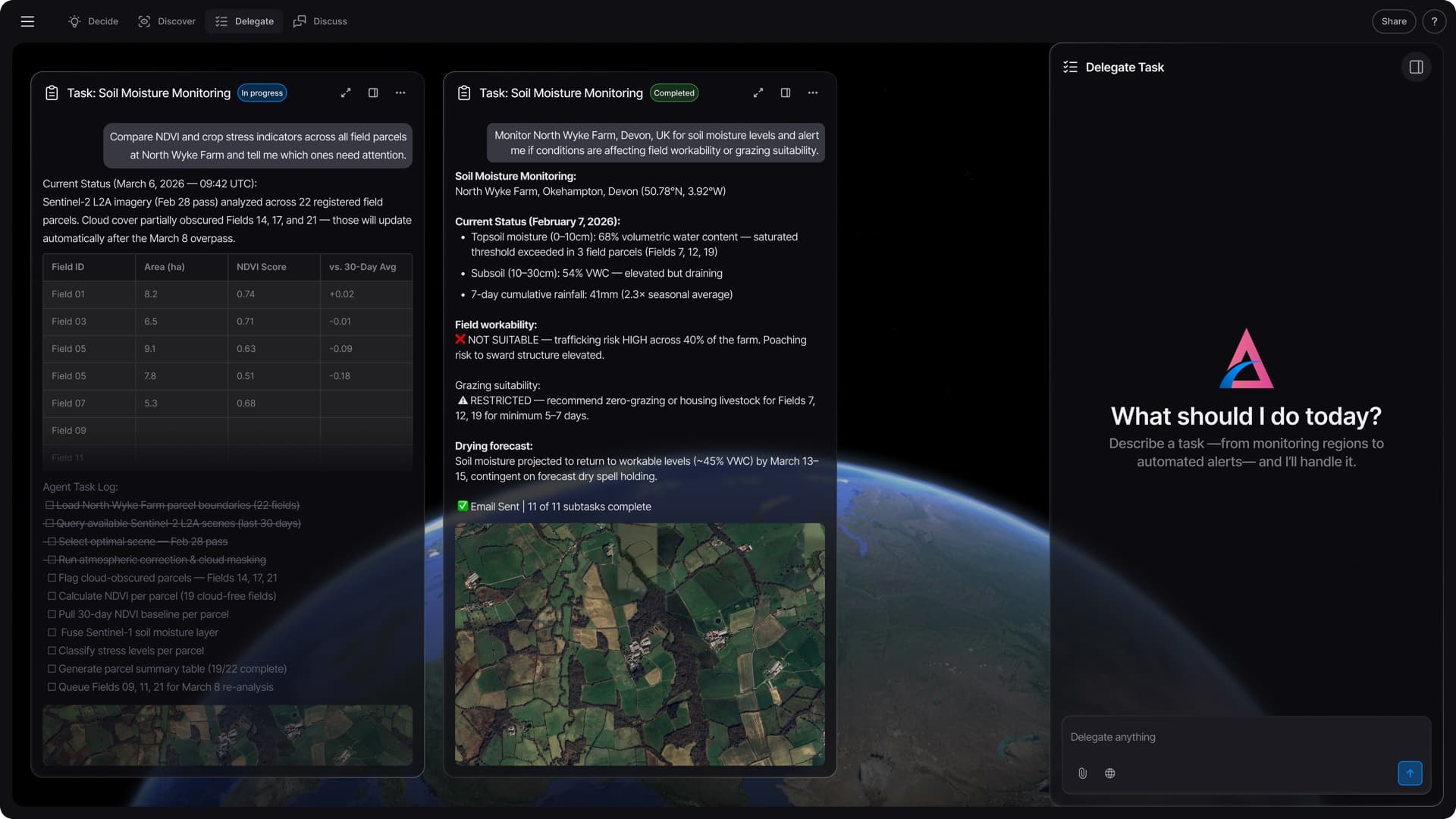
Delegate
Let Amelia work while you sleep.
Tell Amelia what to watch. It monitors continuously and alerts you when conditions change. A 24/7 intelligence system that never misses a signal.
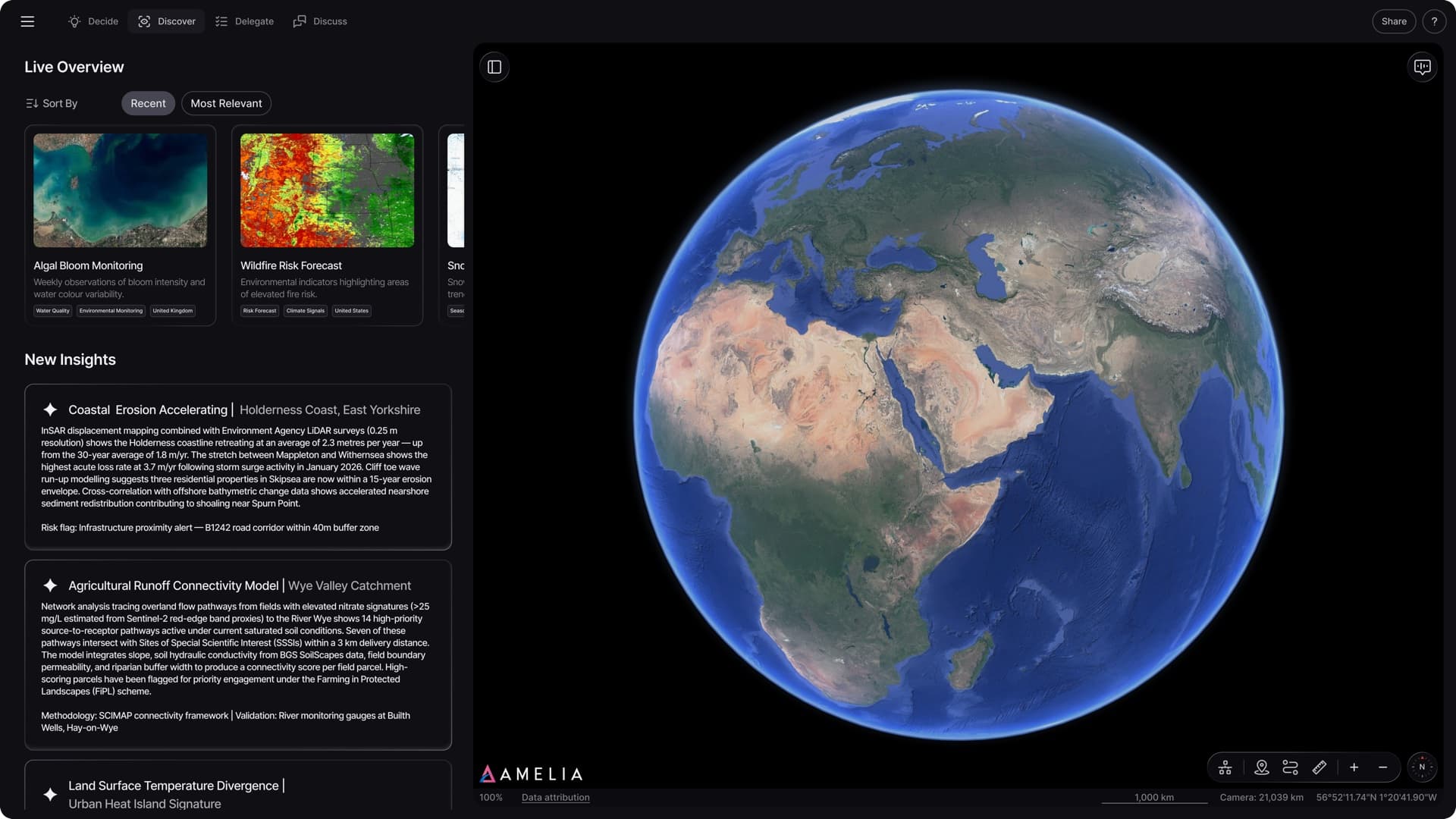
Discover
See what you didn’t know to look for.
Amelia analyses the world autonomously — surfacing patterns, anomalies, and opportunities invisible to conventional analysis. Before you think to ask.
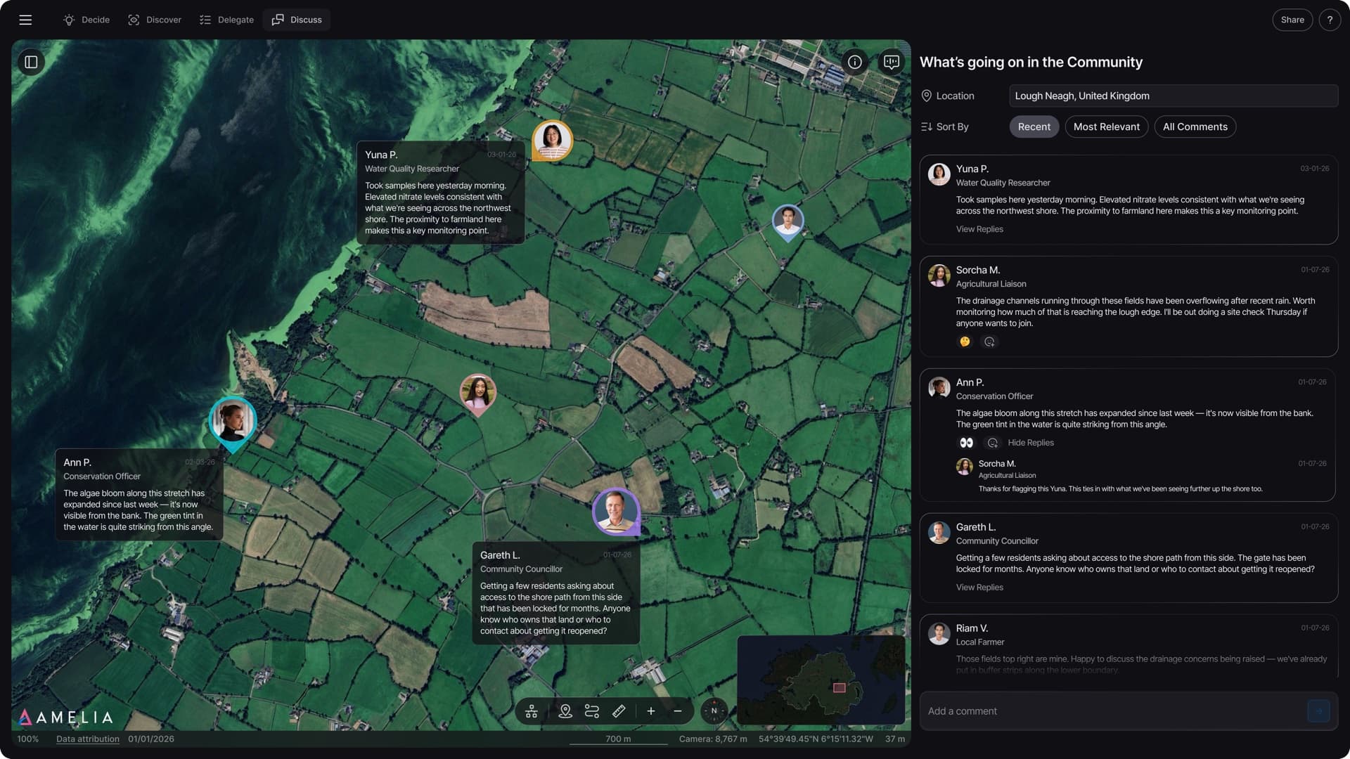
Discuss
EmergingBetter insights with multidisciplinary collaboration.
Researchers, domain experts, and developers contribute capabilities to the platform. A satellite scientist’s analysis alongside a farmer’s field observations alongside a policy analyst’s regulatory context.
Get early access
Drop your email and we'll let you know when your access is ready.